
Nepal: Annapurna Circuit Trek (ACT)

Date: 14th - 25th Sept, 2026

Following the Mulde Hill Trek, I planned for the ACT hike over 13 days. Initially, I intended to start on September 11th, but I needed more recovery time due to calf soreness. This trek is renowned among hikers worldwide, and I noticed many Indians participating, both solo and in groups. On average, one covers about 15 km daily with a 600-meter elevation gain. Along the way, you'll encounter locals, various groups, and porters, making for pleasant conversations. I particularly enjoyed talking with locals and guides more than fellow hikers, as those conversations tend to be more interesting. I packed 1 kg of snacks (flax seeds, pumpkin seeds, sunflower seeds, chickpeas, ginger), ORS, and regular hiking clothes. Typically, I snack once or twice before a big meal. Interestingly, I managed on just one big meal each day throughout the hike, except for one day.

Day 1: We departed from Pokhara around 6 AM, taking a bus to Basishar, located at 760m. Due to fewer hikers, we switched between two jeeps en route to Basishar. I brought boiled eggs for lunch, needing good protein as I usually eat once a day. After reaching Basishar, we had lunch and then transferred to another jeep towards Dharapani, at 1860m. Fellow hikers went one stop ahead, so we had to hike alone to Chame the next day.
Day 2: Chame is about 15 km from Dharapani with a 950m elevation gain, reaching 2710m. After my guide had breakfast, we started early around 7:30 AM. Most of the hike was on the main road, with some sections on off-road trails. It was a bit wet and drizzly at times. We bought a couple of apples from a tea house for a snack. I met a Buddhist monk who allowed me to see inside a small monastery, offering biscuits and tea. Since I don't drink tea, I only took the biscuits. We reached Chame around 12:30 PM and had lunch and snacks there.

Day 3: Our goal was Upper Pisang, 16 km from Chame at 3300m elevation. We started early around 7:15 AM and arrived in Pisang around 12:30 PM. The weather was better, with no drizzle. I met many hikers from around the world. The trail passed through dense vegetation and sometimes along motor roads. You can see many apple farms along the way. I often had Dhal Bhat, a filling meal with refillable items. I don't understand why anyone would choose otherwise.
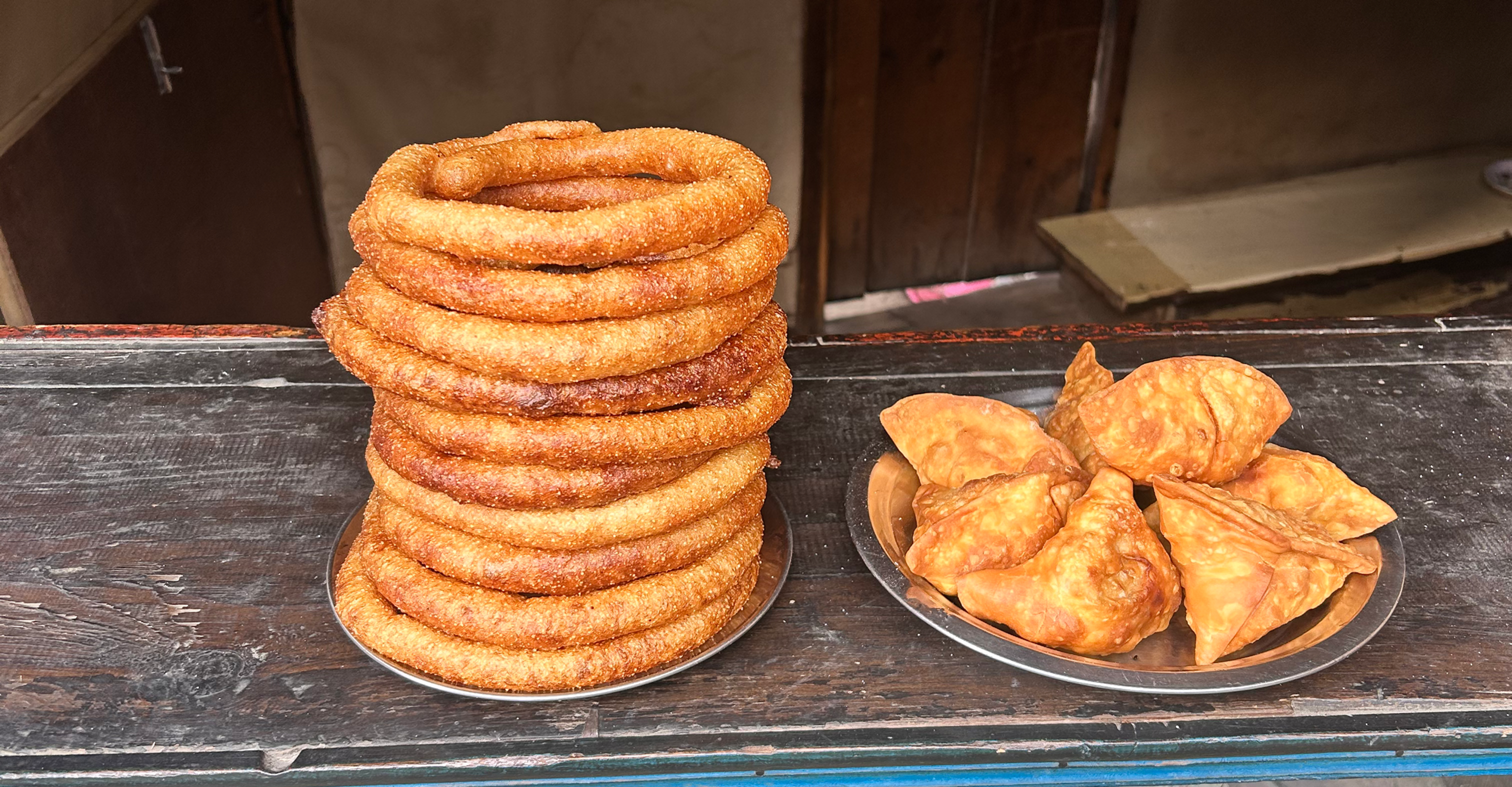
Snacks like chapati and samosa are available in most tea houses.


There's a monastery in Upper Pisang where it's nice to talk to the monks. Unfortunately, I couldn't see inside as it was closed.
Various flowers at the houses of Pisang

Day 4 & 5: We headed to Manang, a major district and popular spot for tourists and hikers. Manang is
about 16 km from Upper Pisang at 3540m. It's a larger town with two monasteries and many hiking spots. Most hiking groups stop here for two days to acclimatize, often exploring higher elevations or visiting the Ice Lake. I felt it would have been better to acclimatize at the next stop rather than Manang. I stayed at Yak Hotel, which was nice and gave a local feel as it's a bit rustic and the oldest hotel. After lunch, I met fellow hikers, including three women (one Nepali working in Australia and two Indians working in the US). However, our paths were short, and we couldn't maintain contact.

Villagers on the way to Manang, overlooking Manang in the middle photo:
Day 6 & 7: Our destination was Tilicho Base Camp at 4150m, about 17 km away. The hike became challenging due to higher elevation, less oxygen, and colder temperatures. By the time we arrived, it was very cloudy. I had lunch around 4 PM but made a mistake by having ginger tea at 6 PM. I thought it was just ginger, but the host added a tea bag. As a result, I couldn't sleep all night, and we had to head to Tilicho Lake at 4900m, 5 km away, starting at 4 AM, which I dislike. My energy levels were low, and it began to snow. Although my oxygen levels were good, I lacked the energy to continue. It was disappointing to see others moving forward. My fingers were frozen and painful, so I had to turn back. That evening, I drank some water, which led to a throat infection and diarrhea, adding to my problems.
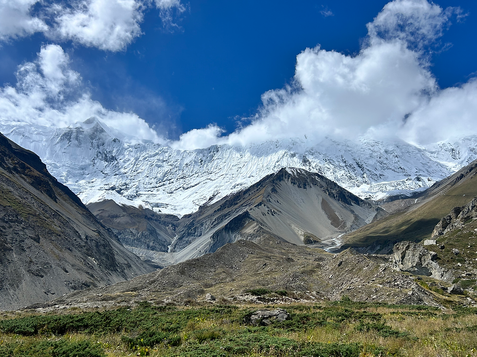
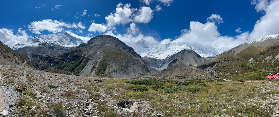

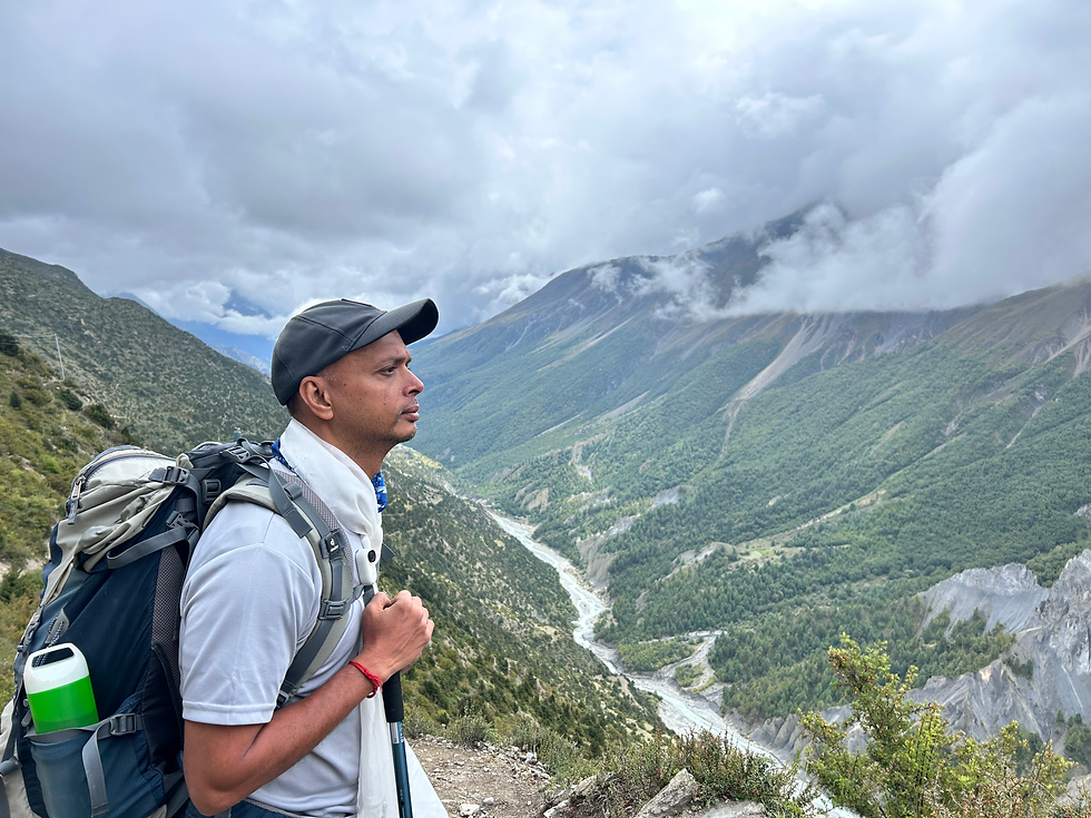
The next day, we were supposed to reach Sri Kharka, but the weather was so clear and beautiful that I tried again to visit Tilicho Lake. After reaching the same point 3 km away, I checked my oxygen levels and heart rate. To my surprise, my oxygen was at 51 and heart rate at 36, while they should be above 75 and 50, respectively. Despite a slight headache, I was shocked. My guide hadn't suggested taking Diamox pills two days earlier, which was dangerous and could lead to unconsciousness. Additionally, the guide forgot the oxygen bottle at the base camp. Again, I had to abandon the hike to the lake and return to the base camp. The host mentioned that oxygen bottles were available at stops for those with this issue, which my guide didn't know. What a disappointment. Anyway, it seemed it wasn't meant to be, so we returned to Sri Kharka.
Day 8: Sri Kharka is about 16 km from Yak Kharka at 4200m. As the name suggests there are lot of Yaks on the way to the village. The hike involves ups and downs, taking around 5-6 hours. The weather was good, allowing for some nice photos. I had a meal at a tea house while chatting with local hikers, which was enjoyable. Apparently, the neighboring tea house owner suffers from vitiligo, so I suggested a remedy that helped my friend.


Day 9: Our plan was to reach High Camp at 4900m in 10 km. The hike was moderate, with clear skies, and we spotted many blue sheep. Hunting them is prohibited, so they weren't shy around humans. The views at High Camp were amazing, so I took time for photos. I had lunch around 4 PM, and the weather turned colder. Unfortunately, it started snowing at night, which I dreaded as my fingers get cold, and I lack waterproof shoes.


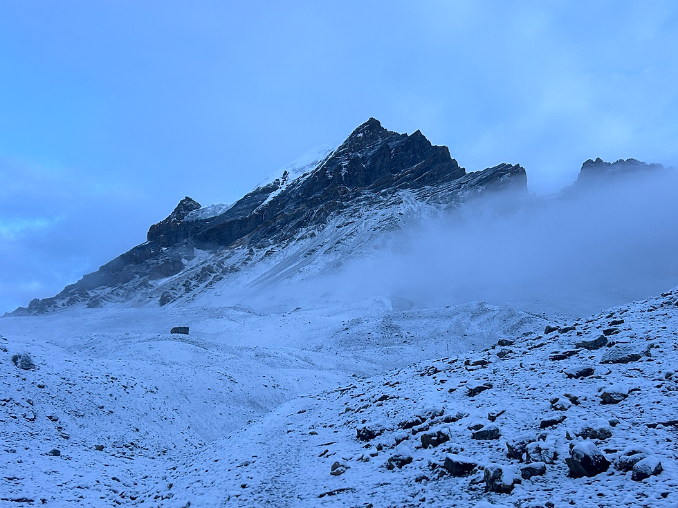
Day 10: To avoid low oxygen levels, I've been taking Diamox daily to hike better. On this day, we needed to cross Thorong La Pass at 5420m and reach Muktinath at 3760m. I barely slept for 4 hours, had to wake up at 3 AM, and start hiking by 4:30 AM. I dislike hiking in the dark, especially when it snows. Smartly, I bought an extra pair of woolen gloves at High Camp and used two plastic covers between socks in my shoes for extra foot protection, which worked. Fortunately, it wasn't snowing much early in the morning.
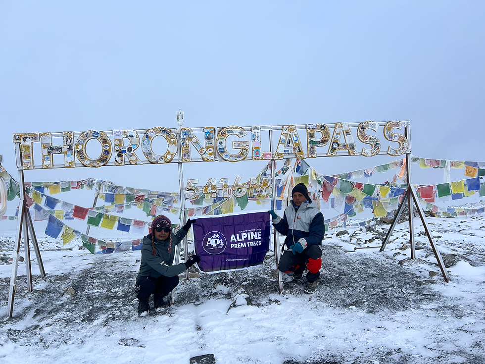
The hike was moderate, mostly cloudy with limited visibility. We reached Thorong La Pass, the highest trekable pass in the world, where there's a tea house for snacks and hot water. We took photos at the pass and headed down to Muktinath. It was a great experience as it was my first hike above 5000m elevation. My next target is 6000m ;).

I had lunch at Muktinath in a guest house, where the food had more options, and I liked it. In the evening, the weather worsened with dense fog and drizzle. I visited the temple to see the hype. It's small, and unfortunately, photos aren't allowed inside. There's also a large Buddha statue.
I planned to buy a panchmukhi mala and Shaligram for a friend, but since the shops were closed in the evening, I postponed it to the next morning.
Day 11: We were supposed to hike to Kagbeni, where the Mustang district begins, but continuous drizzle and a high landslide risk led most guides to abandon the rest of the hike and return to Pokhara due to a public landslide alert, so we headed back to Pokhara.
That night, I had two meals with Ragi Dhal Bhat and Duck curry, which was amazing at Rice Garden. The next day, I enjoyed a delicious chicken noodle soup I cooked at the hotel.
Overall, the trip was good. It would have been great if I hadn't caught a throat infection, fever, and had a more enthusiastic guide.
Here are some of the meals I had outside and cooked myself :)


A Remarkable Annapurna Circuit Journey
— Mr. Vinod
A huge congratulations on completing the legendary Annapurna Circuit and conquering Thorong La Pass! 🏔️🎉
The mountains tested your strength in every possible way. Even when your health became challenging and the journey became difficult, you refused to give up. Step by step, with courage and determination, you continued your journey through the beautiful and demanding Himalayas.
Finally, standing at the end of this incredible high-mountain adventure is a moment to be proud of. This is more than just completing a trek—it is a story of perseverance, courage, and believing in yourself when the journey becomes difficult.
Congratulations once again on this remarkable achievement. May the memories of the Annapurna Himalayas stay…