Georgia: Mestia to Ushguli hike
- v e
- Aug 25, 2025
- 4 min read

Date: 20th to 23rd Aug, 2025

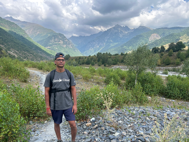
I hadn't known about this 4-day hike, as I was only planning to do day hikes in Mestia. Seeing many tourists embark on it inspired me, though I remained hesitant due to the forecasted rain for the next two days and my lack of a raincoat or rain pants. Despite this, I chose to go ahead with the hike. One reassuring factor was that the route passes through several villages, offering access to water and food each day. This marks my first solo hike ever.
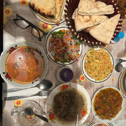
Day 1 (to Zhabeshi): I usually begin my hikes early, around 7 or 8 AM, to allow more time for hiking since I'm a slow walker. However, I was initially unsure about this hike, but after some deliberation, I decided to go for it. All you need is water, a couple of t-shirts, rain gear, and some snacks. I left my bags at the guest house and started the hike around 11 AM. The first few kilometers involved a slight climb, but it soon leveled out. The hike is approximately 16 km, winding around the small hills overlooking Mestia town. I was hiking alone and occasionally met other hikers along the way. To my surprise, the first Georgian I encountered was also hiking alone, as they are typically known for enjoying alcohol, eating, and relaxing. Eventually, you reach a small town called Zhabeshi. The overall elevation gain is around 400 meters, making it an easy hike. I hadn't booked a guest house, so I walked around with another solo hiker to join his guest house. Guest houses generally cost between 20 and 40 GEL, with dinner at 30 GEL and an additional 15 GEL for breakfast. Some places do not offer meat for dinner.


Day 2 (to Adishi): This day was challenging, as you'll soon find out. I began my hike early, around 9 AM, and started walking. I met several fellow hikers, mostly in groups, including a large group of older Chinese hikers. I was impressed that they managed the hike without much discomfort.

The trail is marked with yellow stripes or ribbons, and as the day progressed, the hike became steeper and passed through wooded areas. The intense part began with heavy rain lasting about 45 minutes, as forecasted. Without a raincoat or rain pants, I began to feel a bit cold. Unlike the torrential rains in Indonesia, this was more manageable. I kept walking to avoid getting cold from resting. At the peak of the day, there was a small café with a heater. Sitting inside to warm up was a great relief, as my fingers had become quite stiff.
After a 45-minute break, once the rain cleared, I started descending. Fortunately, it didn't rain again, and the rest of the hike was downhill with increasingly beautiful views. The hike took about 5 hours, though it could take 7 hours if you choose the longer route through the glacier, which I recommend if it's not raining. I arrived at my destination, Adishi, a really nice town. The guest house Bitiquel was the best, costing only 20 GEL with an additional 30 GEL for dinner. Great room, amazing fellow hikers, and excellent service overall. The hike included an elevation gain of roughly 800 meters and a loss of 500 meters, with a total distance of around 10 kilometers.


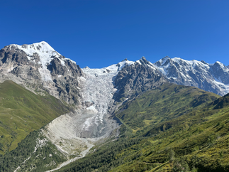
Adishi Village from distance:


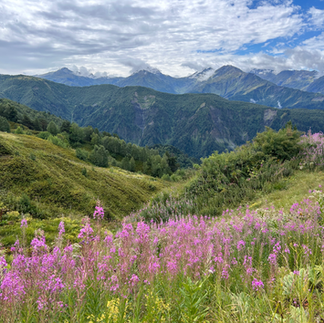
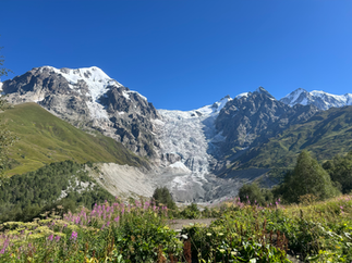
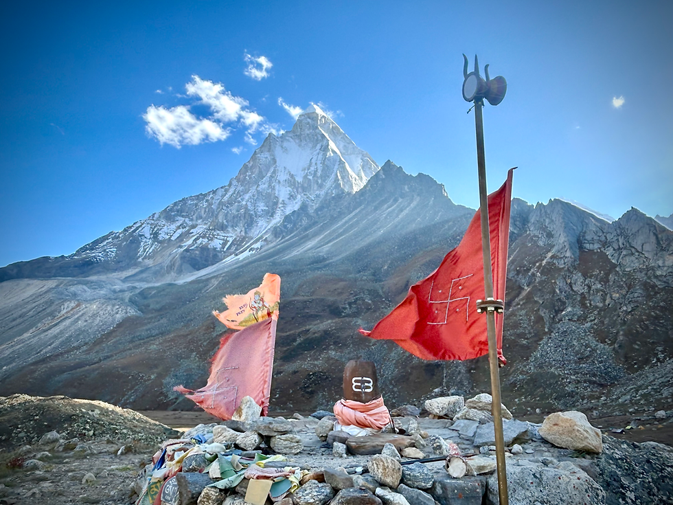
Day 3 (to Iprari): This is another moderate hike with an elevation gain of about 900 meters, reaching the highest peak of the entire hike. The total distance covered is approximately 16 kilometers. It offers stunning views of the Shkhara glacier at the top. As usual, I started my day early at 8 AM and set out. Interestingly, there were horses along the way, and a herd began walking with me, puffing. It was a bit scary but also exciting.


After a while, I encountered the first Indian female hiker I've met, which is unusual for me. Indian women typically don't hike alone, so this was novel for me. She had completed much tougher hikes than I had and seemed to have a good pace, which I noticed. For the most part, we hiked together, taking pictures and exchanging stories about hiking in India, which was a pleasant experience.
Starting from Adishi after 3kms you had to cross the stream, we took the help of the horses who were right on time


After about 8 kilometers, you reach the peak at around 2980 meters, offering breathtaking views of the glacier and surrounding mountains. After this, it was all downhill to Iprari Village. There were nice views on the way down as well. Many hikers from here either take a taxi back to Mestia or walk all the way to Ushguli. I preferred to stay here, although the accommodation isn't that great.


Day 4 (to Ushguli): The village is about 16 km from here and is an easy hike. The trail passes through a lot of forest, and the last 3 km involve walking along the road. At this point, I hitchhiked to the village where I met Steven, whom I had met in Zhabeshi. We walked another 10 km to the glacier and back, totaling 30 km of walking, which left me tired by the end of the day. I took a taxi with some Germans back to Mestia on the same day because I didn't want to lose another day. In Mestia, I ate a large amount of food since I hadn't been eating well. During the hike, I was mostly surviving on the nuts I had bought.


Overall, I'm pleased that I completed this hike, which I could have spread over 2 or 3 days. It seems there's a more picturesque route on the fourth day mentioned in Caucus Trekking. I used this hiking guide link for the trek.


Comments